
We have been treated yet to another rare natural spectacle involving a mysterious island formed four years ago in the South Pacific island nation of Tonga. According to NASA scientists, this piece of wonder is not disappearing under the ocean anytime soon.
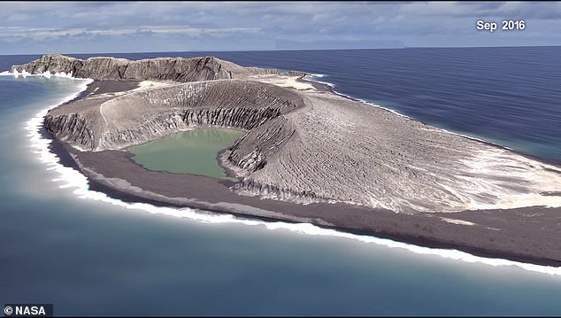
The island is one of the three that have erupted in the last 150 years and survived the oceans eroding waves for more than a few months. It formed as a result of an eruption that occurred near the nation of Tonga. It sprung up between its two older islands, Hunga Tonga and Hunga Ha’apai in January 2015.
The new island was caused by a volcanic eruption near the nation of Tonga and sprung up in January 2015

So far, the island has no official name and is referred by the name HTHH, a combination of the names of two islands its nestled between.
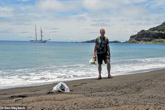
It's only recently that scientists set foot on the island. Dan Slaback from the NASA’s Godard Space Flight Center in Greenbelt, Maryland were the first group to arrive on October 2018, alongside other scientists and students arriving on a Woods Hole’s sea Education Association Semester’s South Pacific Cruise.
The island has no official name and is referred to using the combined names of the two islands its nestled between, Hunga Tonga-Hunga Ha'apai or HTHH
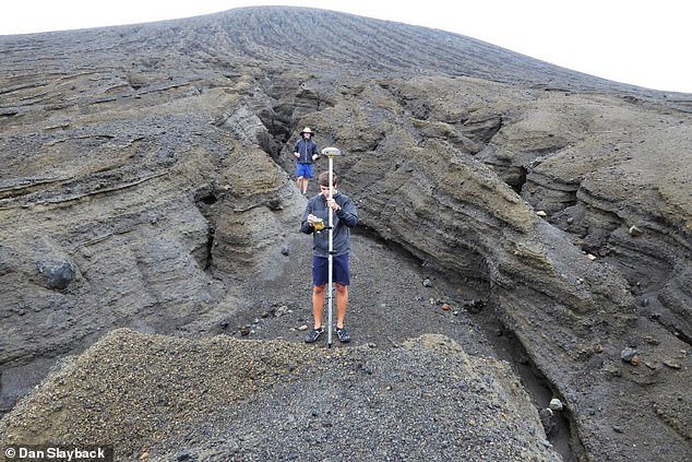
The team used a drone to take an aerial survey to be used to make a 3D model of the Island. They also used 150 GPS measurements to try and measure each location’s elevation.
Speaking about his experience in the island, Slayback said: 'It really surprised me how valuable it was to be there in person for some of this. It just really makes it obvious to you what is going on with the landscape'
Dan Slayback (pictured above) of NASA's Goddard Space Flight Center in Greenbelt, Maryland, visited the island in October 2018 to collect samples and data
Most of the island’s surface is covered in black gravel the size of a ‘pea’. Light colored clay has also been observed to be washing away out of the island’s cone into the ocean.
'Even though we'd seen it we didn't really know what it was, and I'm still a little baffled of where it's coming from. Because it's not ash,' Slayback said, referring to the clay. Some scientists have described the mud as very sticky.
The team visiting the island took around 150 GPS measurements that narrow down each point's location and elevation to better than 10 centimeters
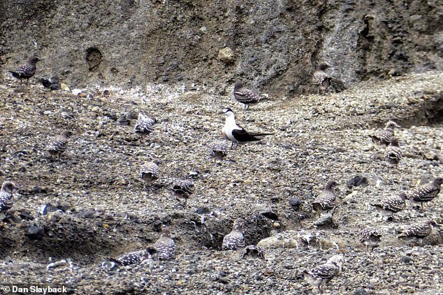
The island has already started feeling like home to a few animals. A barn owl has taken residence as well as hundreds of nesting sooty terns. Some vegetation has also started growing, connecting the island to its neighbors.
Scientists have taken soil samples to determine its mineral analysis as well as work out how long the island will last.
A drone was used to take an aerial survey of the island. All the data will be used to develop a realistic 3D model of the island
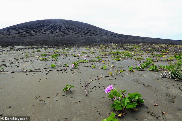
A few animals are living on the island including a barn owl and hundreds of nesting sooty terns
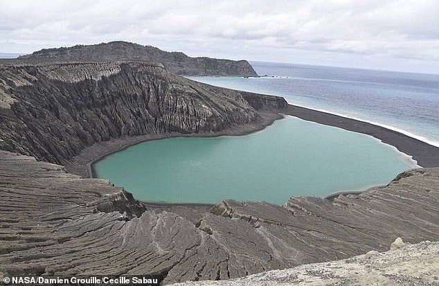
The island is described as 'pretty flat,' but there are gradients and patterns caused by waves
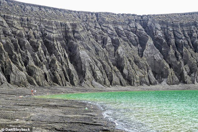
The island looks flat from the satellite images, but scientists confirmed that it was not entirely true. In fact, gradients and patterns formed by wave erosions could be observed as well as huge erosion gullies.
The visiting team according wasn’t very comfortable with the excursion according to Slayback.
'Okay, this wasn't here three years ago, and now it's two meters deep'
Scientists believe the island will also give them clues about how volcanic landscapes interacted with water on ancient Mars
The team will use the data collected to determine the island's mass and volume of volcanic material that erupted from the vent. They also believe the island will give them clues about how volcanic landscapes interacted with water on ancient Mars.


